


It seems like people of all ages are looking for good summer reading. Here is a different type of reading list for the whole family that can be done together while also getting you outside: Reading clouds and predicting the weather.
Clouds are categorized by their structural characteristics (cirrus, stratus, cumulus and nimbus) and the height in the atmosphere at which they develop (high, middle, low and clouds with vertical growth).
Cirrus
Cirrus clouds are high-level clouds that develop between 16,000 and 50,000 feet. They tend to be comprised primarily of tiny ice crystals. They are only found at the top of very high mountains or at cruising altitude in a jet plane.
Cirrus comes from the Latin word “cirro” which means curl of hair, and these clouds look like thin wispy hair. Cirro can also be used as a prefix to describe high-level clouds. While cirrus clouds usually indicate fair weather in the immediate future, they can also accompany a strong jet stream in the upper atmosphere and can also be seen preceding a surface front by day or two. By observing their movement and the direction that their streaks are pointed, you can get an idea which direction the front is moving.

Cirrostratus are sheet-like and cover the whole sky, and you can usually see sun or moon through them. These clouds indicate moist weather within the next 12-24 hours. Cirrocumulus tend to be large groupings of white streaks that appear to be neatly aligned. In most climates, it means there is fair weather for the near future, but in the tropics, it could indicate an approaching tropical storm or hurricane, depending on the season.
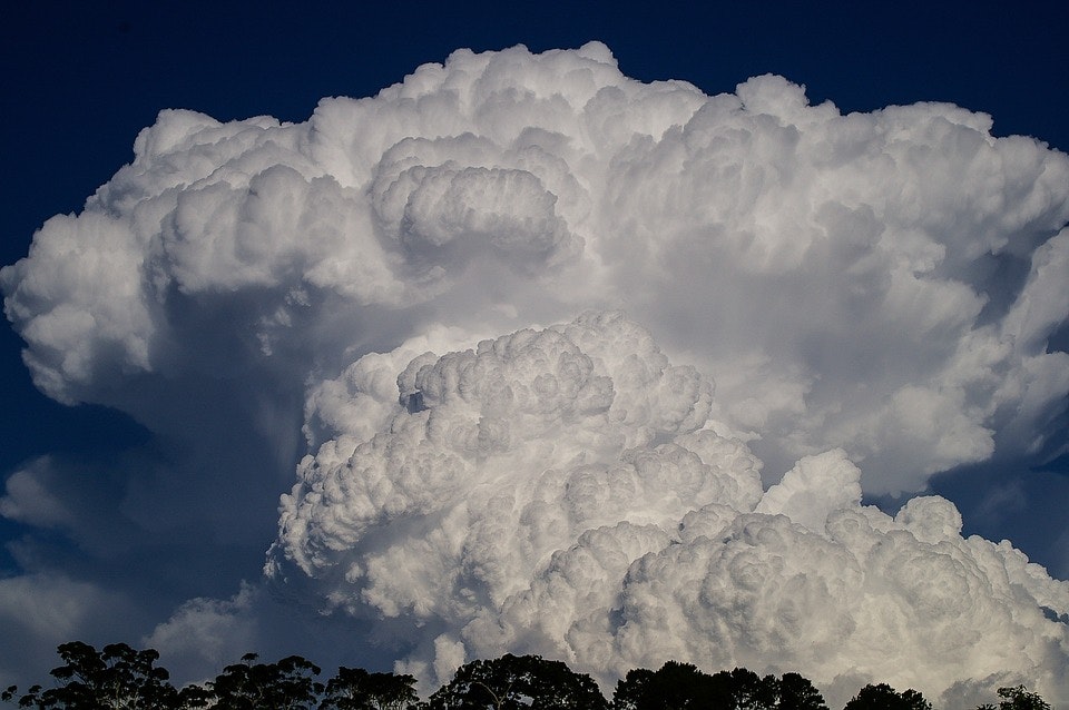
Cumulus

Cumulus is from the Latin word “cumulo” meaning heap or pile. Cumulus clouds look like puffy white cotton balls and appear detached or isolated from other clouds. They form a few hundred to a few thousand feet above the earth’s surface. In the desert southwest and New Mexico, they can form in even higher altitudes due to the warm air conditions.
Stratus
Stratus clouds often form as a hazy white or gray sheet and often block sunlight. Seen primarily in the lower part of the atmosphere, they can also be found in the middle (altostratus) to upper (cirrostratus) parts.
Altostratus clouds are gray and/or blue that cover the whole sky and tend to indicate a storm in very near future. Altocumulus clouds are grayish white in large fluffy sheets and indicate thunderstorm within the next six hours or so.
Nimbus
The nimbus clouds are a combination or hybrid of different cloud categories. “Nimbo” is rain in Latin, and the nimbus clouds are layered clouds that precede rain or precipitation. They can extend into middle or upper part of the atmosphere but are typically seen at the lower level because they obscure other clouds above them. Cumulonimbus are known as thunderstorm clouds at form from lower to upper levels. Altocumulus form at the middle level between 12,000 and 18,000 feet. The altocumulus standing lenticular or “wave clouds” are common on the leeward side of topographical barriers such as mountains where a stable layer of air is found above the crest of the topography
You can learn more by visiting the Jetstream website by the National Weather Service and find diagrams and images. Have fun with your summer cloud reading!
